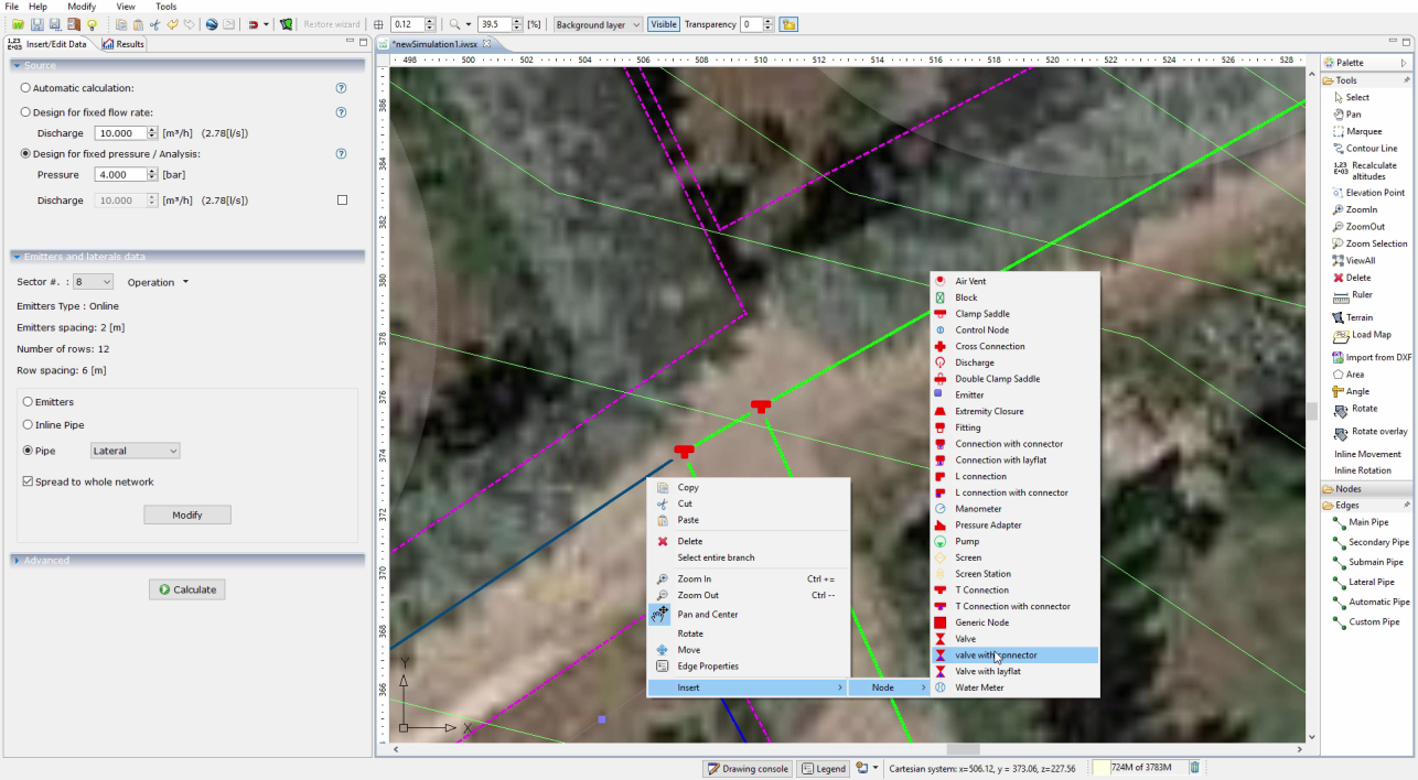


To insert any component of a system (pump, filters, fittings, valves, drains, etc.)

Irrigation with pop-up

Irrigation with sprinkler
Drip irrigation
FUNZIONALITA'
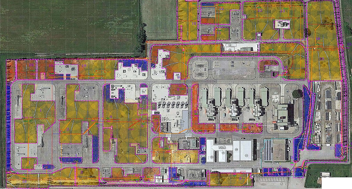
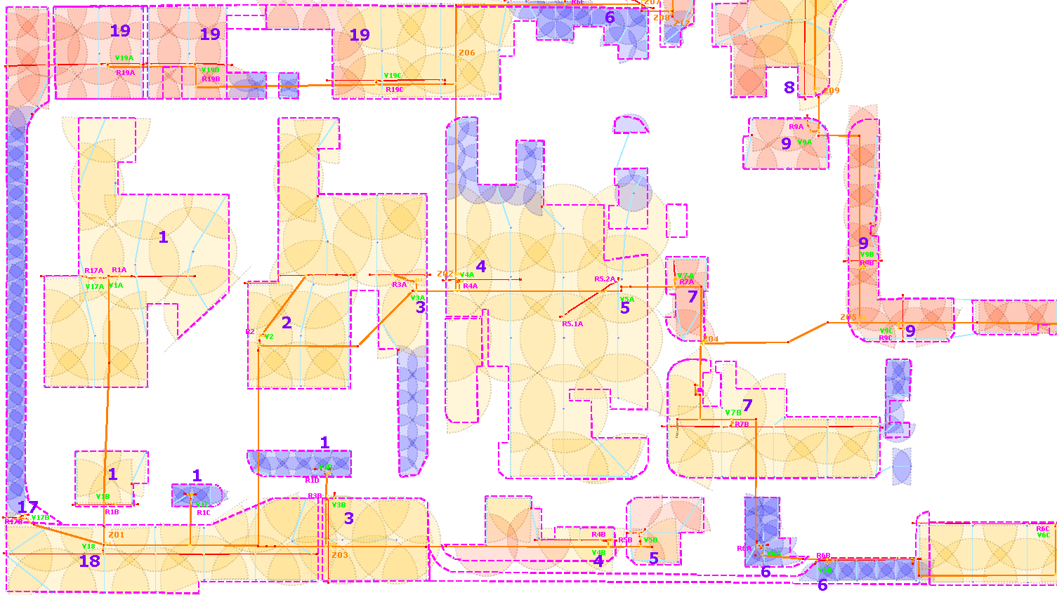
Extension
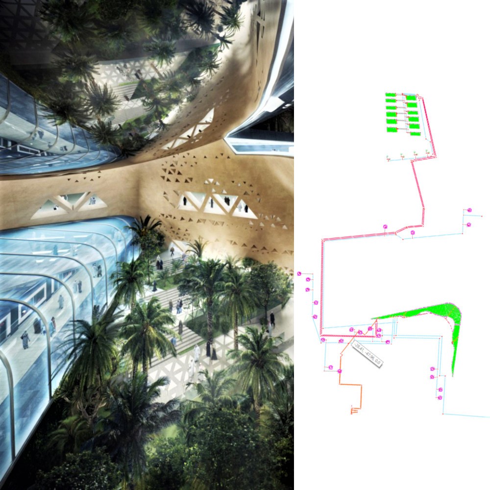
Google Maps
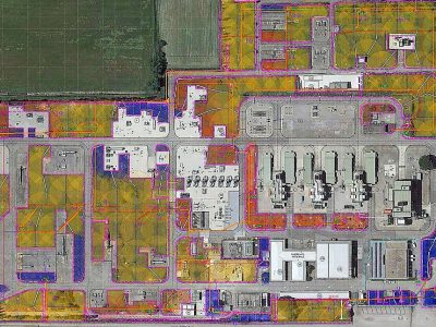
Import images
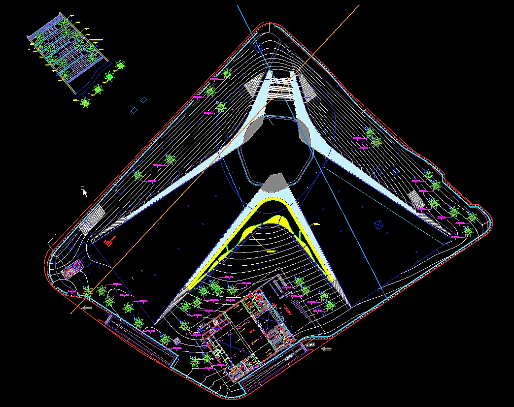
CAD import
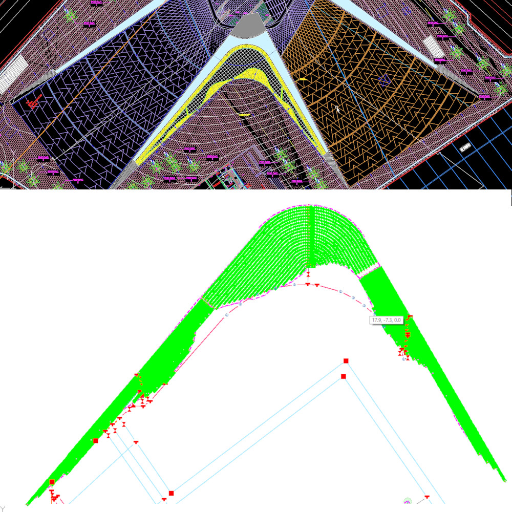
Slope calculation
Hydraulic calculation
Advanced shift management
Pump Calculation
2D graphics
Calculation report
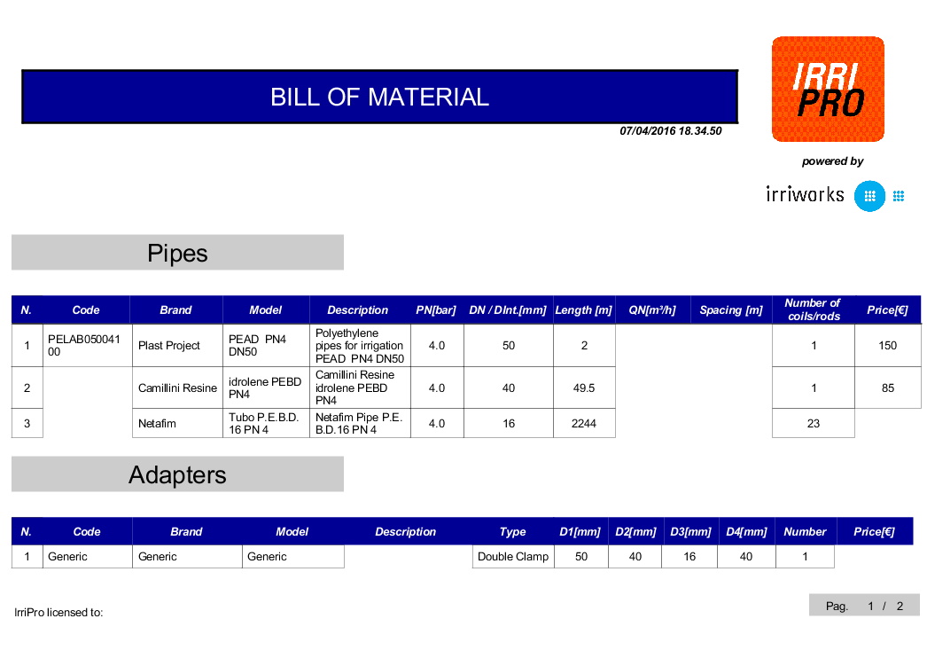
Bill of materials
CAD export
PDF export
IrriRT
- 30 [Ha]

Info
- also arranged on levels at different elevations
- 3D model processing with slopes
- Images of several formats and scaled
- with automatic quote processing
- advanced interpolation algorithm
- rigorous hydraulic algorithm
- To automatically manage the valves
- calculation of head and operating points
- of the calculated hydraulic quantities
- Numerical and textual summary of the results
- List and quantity of all system components
- Types divided by layer, with symbol legend
- To scale, with legend and footer

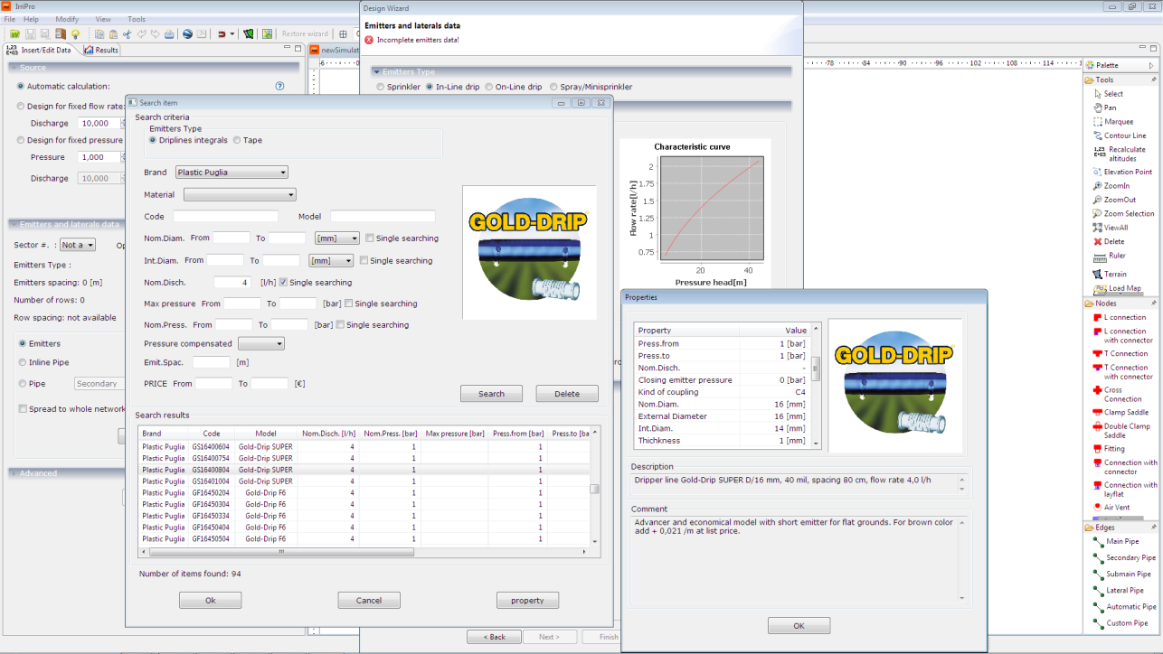
More info on Database

The IrriGa database has more than 30,000 items and is updated frequently thanks to the continuous contribution of producers and partners. For each element of the database are shown the hydraulic, geometric, prices and technical information. If a product there isn't in the database, you can easily put it through the new importation function.